Little Pamir 22 day
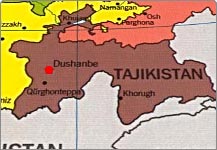

Tajikistan weather and climate
Cities | Country Facts | Getting in&out | Customs | Getting around | Money Communication | Safety | Healthcare | Food&drink |Festivals | Maps
Tajikistan's climate is vary due to elevations, in general continental, subtropical, and semiarid, with some desert areas climate zones are presented. The lowlands such us Fergana Valley and others are shielded by mountains from Arctic air masses, but temperatures still may drop below zero during winter months. The highest average temperatures can be expected in the subtropical southwestern lowlands, which have arid climate. In average temperature for lower elevations, is 23° to 30° C in July and -1° to 3°C in January.
In Pamirs, the average July temperature is 5° to 10°C, and the average January temperature is -15° to -20°C. The average annual precipitation for most of the republic ranges between 700 and 1,600 millimeters. Best time to visit July-October.
The section of Pamir highway in range between Khorog and Kyrgyz Border at Kyzyl Art pass is going over 4000 metres above sea level with its highest point at Ak baital pass at 4655 m. The one can expect showing here at any time and notorious winds even during clear sky.
Home | Travel Basics | Tours | Visa&Formalities | Must See| FAQ's | About us